.svg)

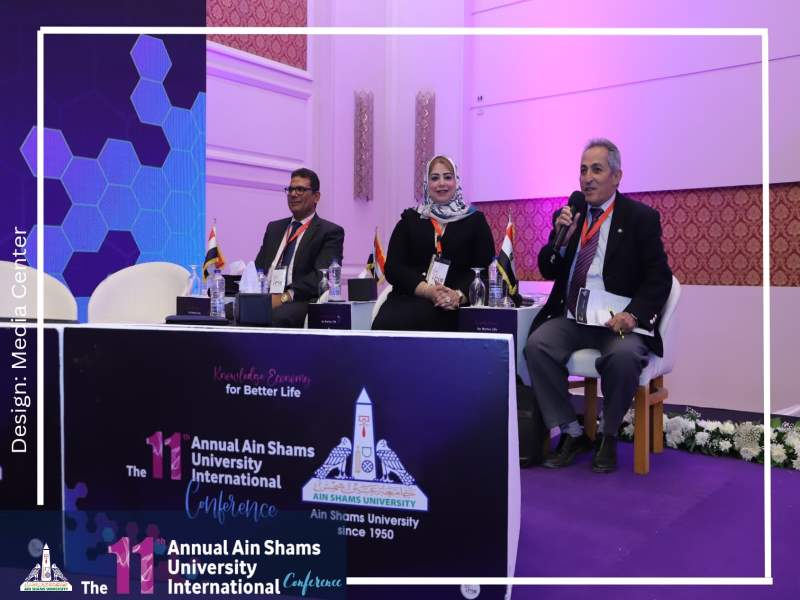
A session entitled Remote Sensing (in cooperation with the National Authority for Remote Sensing and Space Sciences and the United Arab Emirates University) in the activities of the second day of the 11th Annual Ain Shams University International conference
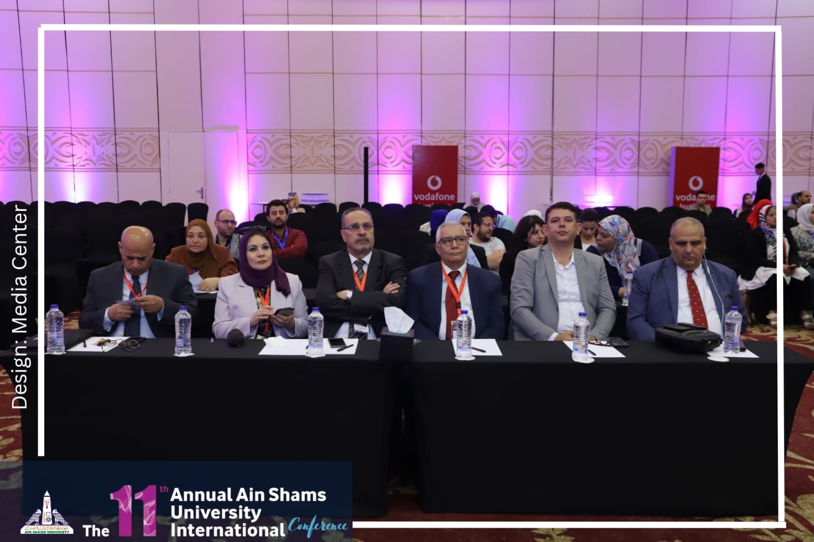
The activities of the second day of the 11th Annual Ain Shams University International Conference under the title "Knowledge Economy... For Better Life" witnessed a session entitled Remote Sensing (in cooperation with the National Authority for Remote Sensing and Space Sciences and the United Arab Emirates University)
 |
 |
|||
The session chaired by Prof. Abbas Zaghloul, Professor Emeritus at the National Authority for Remote Sensing and Space Sciences, Prof. Mohamed Othman Arnous, Professor, Department of Geology, Faculty of Science, Suez Canal University, Prof. Rasha Hamed Bunduq, Professor, Department of Geography, Faculty of Education, Ain Shams University
 |
 |
|||
Prof. Ahmed Ali Murad, associate deputy for scientific research at the United Arab Emirates University, presented the experience of the UAE University as a model in the United Arab Emirates for the use of remote sensing techniques and geographic information systems as a tool for deep understanding of technical challenges related to the goals of sustainable development, where the focus was on studies related to water resources as water security as it is a basic necessity to achieve the goals of sustainable development.
Where remote sensing and geographic information systems were used to identify aquifers and identify changes in water quantities, especially the shallow aquifer. There are also other studies to identify the changes that occur in the vegetation cover, which indirectly helps us to identify the abundance of water. There are studies that used remote sensing data and geographic information systems to support hydrological models in the various study areas in the United Arab Emirates, and other studies that review changes in vegetation cover, surface runoff, and water bodies behind dams.
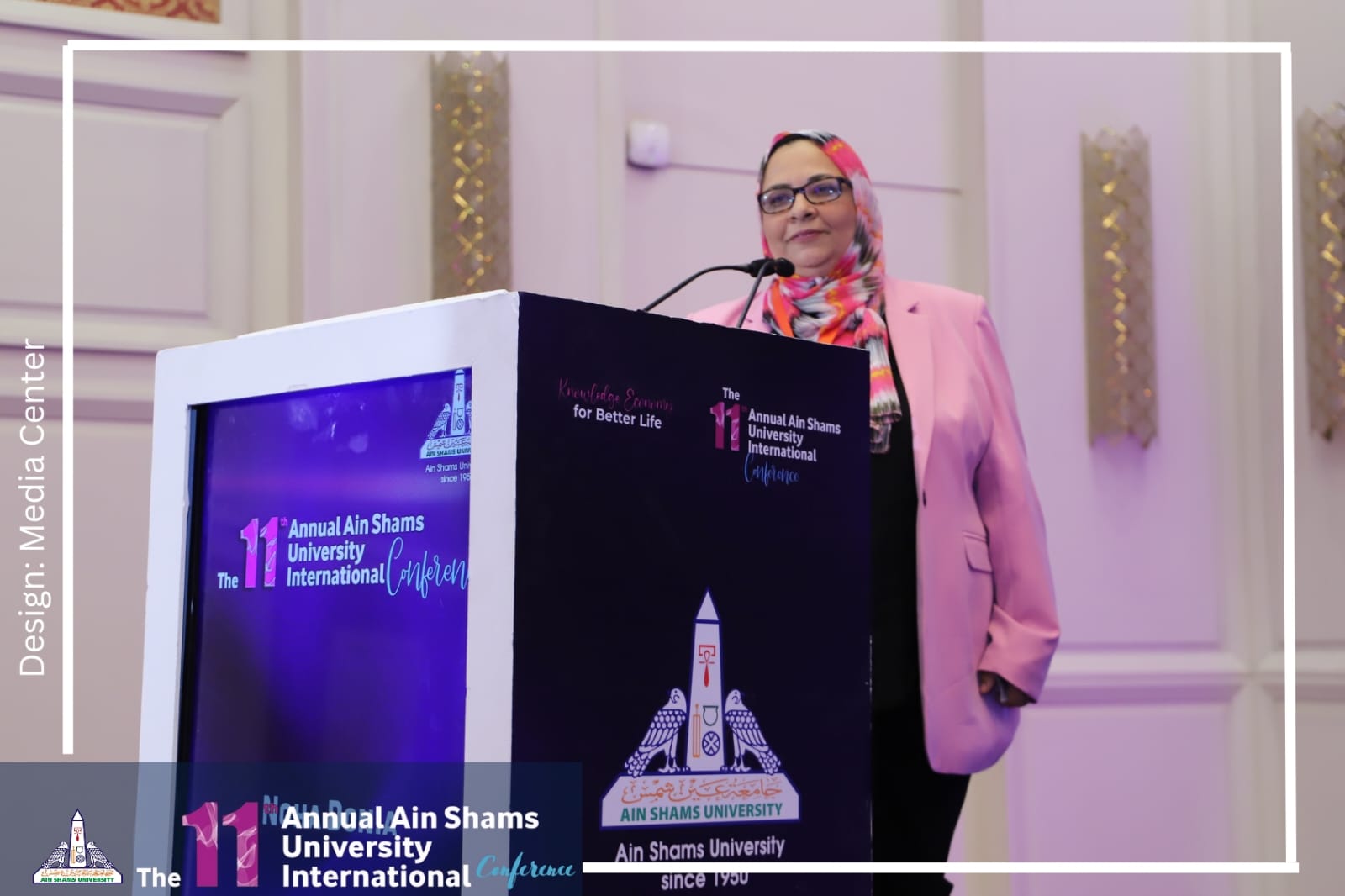
In her speech on forecasting torrential rains using remote sensing techniques and geographic information systems, Prof. Noha Samir Donia, Dean of the Faculty of Graduate Studies and Environmental Research, said that remote sensing technology can be used to collect various data and data that help build predictions of what might happen in the event of a flood, with the aim of obtaining results that help make decisions in a timely manner, and protect the population as much as possible. Or reduce the size of losses in the event of a disaster. Satellite visuals help in obtaining field data during the occurrence of a disaster, but the accuracy of the image determines the type of this data and its contribution to estimating the risk of flooding. In this study, reliance was placed on highlighting the significant and effective role of remote sensing technology and extrapolation and elicitation of various information from its various remote sensing sources to highlight the importance of remote sensing in the field of flood risk assessment.
Regarding the capabilities of the National Authority for Remote Sensing and Space Sciences in the knowledge-based economy, Mr. Ali Hermas, Professor and Head of the Geological Applications and Mineral Resources Division of the National Authority for Remote Sensing, Geology Applications Sector - NARSS, discussed the potential of NARSS in the knowledge-based economy.
The speech addressed the pillars of knowledge-based economy (KBE), educated and skilled workforce, innovative national system, network building and some examples of NARSS services to society.
The speaker referred to the history of the Remote Sensing Authority starting from 1971-1991 >> Remote Sensing Center at the Academy of Scientific Research, then 1991-1994 >> The General Authority for Remote Sensing - Ministry of Higher Education and Scientific Research and from 1994 until now the National Authority for Remote Sensing and Space Sciences - Ministry of Scientific Research NARSS operates in two main areas:
- Space Science and Technology the space science and technology sector is interested in developing payload sensors for Earth observation via satellites while facing the challenges of sensor design, satellite data communications, and data reception and processing. Our ultimate goal is to launch Egyptian remote sensing satellites.
- The field of Earth observation applications in which remote sensing uses data provided by Earth observation satellites and airborne sensors to retrieve geophysical and biophysical parameters of the Earth's surface, produce maps and geospatial data, evaluate and monitor natural resources, natural hazards and manage the environment.
On monitoring and following up on natural hazards resulting from human activity and climate change, Mr. Muhammad Bastawisi, Head of the Geology Applications Sector - NARSS, Professor and Head of the Biological Applications and Mineral Resources Division at the National Authority for Remote Sensing and Space Sciences. He talked about water in a changing climate, as climate expectations indicate that the Middle East and North Africa region will be controlled through the pattern of precipitation.
His Excellency referred to the techniques of adaptation to water and water scarcity (groundwater reserves) - emerging technologies where radar sounding uses low-frequency microwave signals that enable penetration of the earth's surface up to hundreds of meters where the OASIS and DESERT-SEA projects can provide, for the first time, a unique opportunity to make measurements Extensive geophysical survey to determine aquifer boundaries and groundwater dynamics in the desert core.
He added that Egypt's contribution to such projects by allocating funds and researchers early in such missions could provide access to valuable data for mapping aquifers in the heart of the desert and thus adding to Egypt's future groundwater reserves.
About geospatial artificial intelligence to support sustainable urban development in Sinai, Prof. Fayrouz Mohamed Hassan spoke.
Prof. Dr. Fayrouz Hassan, Assistant Professor, Department of Geography, Faculty of Girls, referred to a study using geospatial artificial intelligence technology and its integration with geospatial technologies to support sustainable development in the Sinai, as the Sinai Peninsula is a dear part of the Egyptian state, rich in its unique and diverse natural resources. This study will focus on how to use geographic information systems and remote sensing techniques and their integration with geospatial artificial intelligence technology to choose the most suitable places for sustainable urban development in the Sinai Peninsula. The study also focuses on the basic elements that are considered the main determinants of any urban development to ensure that such urban development is sustainable, compatible and harmonious with the surrounding environment so that we ensure that the environmental elements do not negatively affect the new urban areas and the urban areas do not negatively affect the elements of the surrounding environment for real development sustainable.
Geospatial artificial intelligence was used in this study in many stages of its preparation, especially in analyzing satellite images to extract a map of land use and land cover using the neural network classification algorithm, which is considered a supervised machine learning algorithm. The geospatial artificial intelligence algorithm was also used. Known as the Principal Component Analysis Algorithm, it is considered an Unsupervised Machine Learning Algorithm, and this algorithm is known as the K-Means Clustering Technique. This is in addition to the use of geospatial artificial intelligence in building forecast models and identifying the most suitable sites for sustainable urban development. This is in addition to its use during the process of preparing geospatial data and preparing it for use in the required models, in addition to extracting many complex data such as the network of valleys from the three-dimensional models of the earth’s surface easily and without manual intervention in drawing those valleys. Artificial intelligence was also used to predict the locations of natural disaster risks, especially disasters of floods and landslides, to avoid putting any urban development in those dangerous places to ensure the sustainability of development in Sinai.
Concerning the integration of remote sensing data and spectral analysis to detect areas contaminated with heavy care, Prof. Saeed Mohamed, Professor and Head of the Soil Department at the National Authority for Remote Sensing and Space Sciences, spoke about the issue of soil pollution as a major threat to global health, food security and agricultural productivity, and how heaviest metals have effects Toxic to plant and soil microorganisms when they exceed the permissible limit.
Where in Egypt, about one million feddans in the Nile Delta and the valley, wastewater is used for irrigation, which leads to an increase in the effect of heavy metals on the physical and chemical properties of the soil.
For example, Bahr El-Baqar Drain collects and transfers wastewater from Qalyubia Governorate and Northeast Sharkiya to Lake Manzala. The problem comes from the reuse of wastewater in Bahr El-Baqar for irrigation without proper treatment that may cause negative effects on soil, crops, animals, and human health.
Therefore, it is important to find a non-traditional methodology to detect soil contamination.
On environmental monitoring and assessment using distance sensing and cartographic models, Dr. Ahmed Al-Zaini, Assistant Professor and Head of the Environmental Studies Department at the National Authority for Remote Sensing, talked on the environmental monitoring of environmental resources, infrastructure and historical areas, as they are subject to deterioration as a result of climate changes, especially in coastal areas.
From east to west of the northern coast of Egypt. Many archaeological sites have been threatened by the salty sea water, and others have completely disappeared (drowned) due to long-term climate change phenomena.
Also, due to changes in sea level, receding and erosion of the coastal zone creating new land cover, space technologies have become familiar tools in stopping land use/land cover changes in the short and long term.


