
.svg)

Geospatial Intelligence for Smart and Sustainable Urban Development Track
2026-07-06About Track
 |
Faculty of Arts |
Geospatial Intelligence for Smart and Sustainable Urban Development Track
A geospatial pathway connecting smart cities, sustainable urban development, mapping, and climate-aware planning
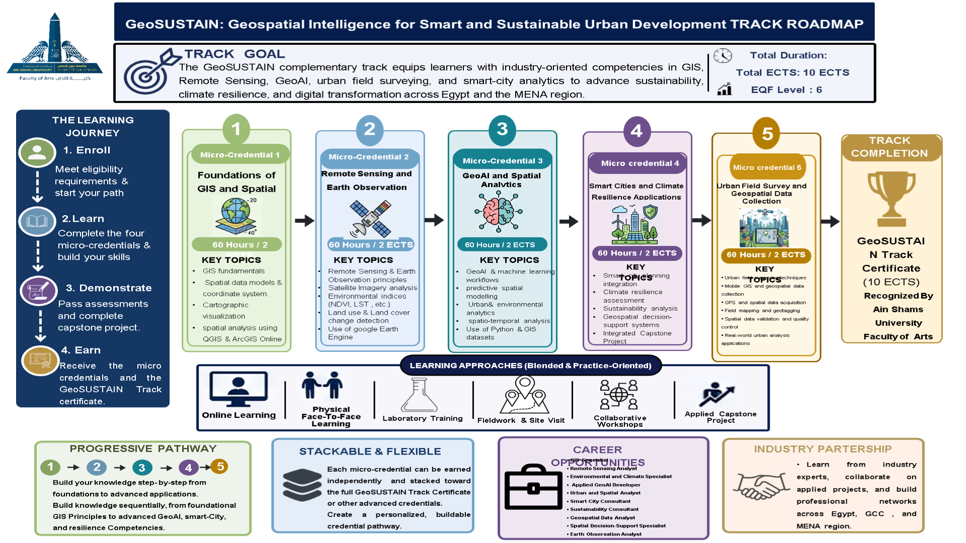
Track Map
Track Features
|
Why Choose This Track? ✅ Practical, field-based training supported by real-world projects ✅ Accredited certificates that enhance your employability in the job market ✅ Learning from leading academics and industry experts ✅ Flexible track as you can earn each credential separately or complete the full track
|
More Information

Was this Page Helpful ?
